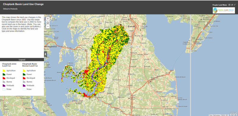
Land use changes
in the Choptank Watershed
Click on the map Below to compare recent land use and 2002 land use in the choptank watershed
The Maryland
Department of Planning uses the following categories to define the land uses within an area.
• Developed – includes residential, industrial, institutional (such as schools and churches), mining, and open urban lands (such as golf courses and cemeteries)
• Agriculture – includes field, forage, and row and garden croplands; pasturelands; orchards and vineyards; feeding operations; and agricultural building/breeding and training facilities, storage facilities, and built-up farmstead areas
• Forest – includes deciduous forest, evergreen forest, mixed forest, and brush
• Water – includes rivers, waterways, reservoirs, ponds, and the Bay
• Wetlands – includes marshes, swamps, bogs, tidal flats, and wet areas
• Barren – includes beaches, bare exposed rock and bare ground
Human Impacts on the Choptank Watershed
Portions of the Choptank River have been identified as “impaired
waters” under Section 303(d) of the Federal Clean Water Act due to high levels
of nutrients and sediments. Intensive
agriculture and human waste disposal provide the largest sources of Nitrogen
and Phosphorus. The primary sources of terrestrial nutrients in the Chesapeake Bay
and the Choptank are similar. Overexploitation
of fish and shellfish populations has compounded water-quality problems.
Overfishing has resulted in diversity loss and progressive dominance by
short-lived, pelagic species. The ecosystem consequences of overfishing are
similar to those of nutrient enrichment and can interact with enrichment in
complex ways. Collectively, these anthropogenic effects on nutrient inputs and
trophic structures are referred to as ‘‘cultural eutrophication.’’
Table1:The
following data shows the relationship between land use and water quality in the sub
watersheds within the Choptank Watershed monitored by UMCES Horn Point Laboratory (Dr. Fisher's lab group) between 2003 and 2006.
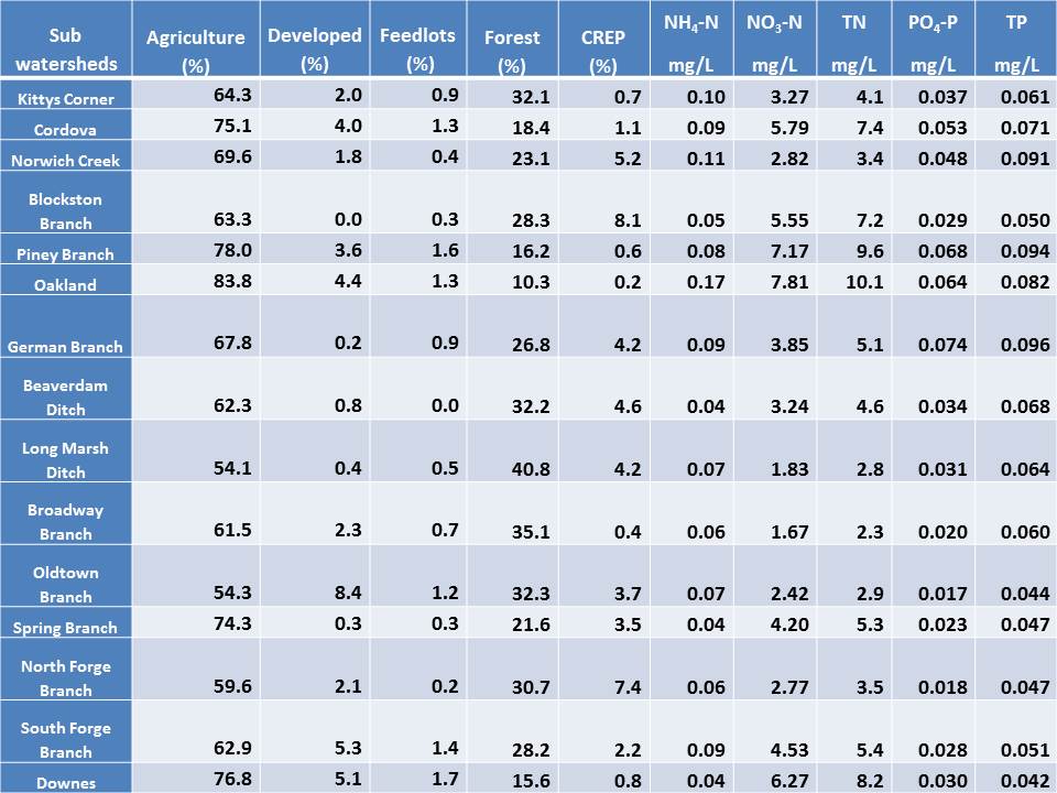
Click on the map below to explore the subwatersheds
|
In summary
Three main watershed characteristics determine the magnitude of increased nutrient export to coastal waters: (1) human population density (2) intensive agricultural production and (3) the ratio of terrestrial drainage area to aquatic area. |
Ways to improve water quality
Best
Management Practices (BMP)
Best Management Practices (BMPs) is a term used to
describe a type of water pollution control.
BMPs are techniques, measures or structural controls used to manage the
quantity and improve the quality of surface and ground water runoff. The goal of BMPs are to reduce or
eliminate the contaminants collected by storm water as it moves into streams
and rivers.
Source: http://www.epa.gov/nrmrl/wswrd/wq/stormwater/bmp.html
Source: http://www.epa.gov/nrmrl/wswrd/wq/stormwater/bmp.html
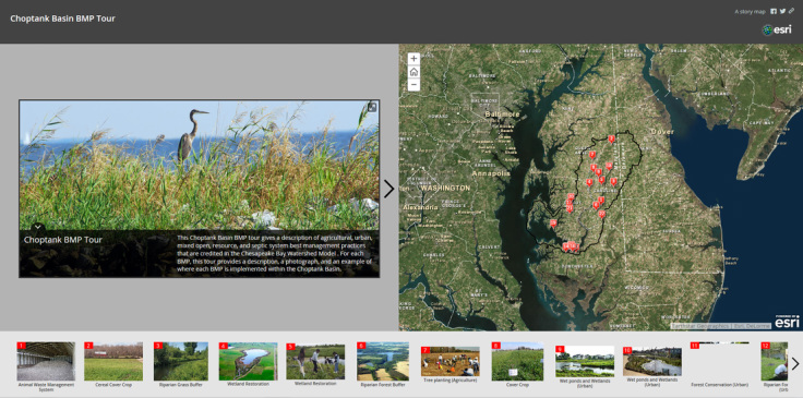
Click on the tour above for examples of BMPs sites within the Choptank Basin, with pictures and descriptions.
